Nature Wildlife
Scenic
Family Friendly
Westland District Walks, from easy loop walks to day tramps. Call into the isite for more information.

Time: 15 minutes
Distance: 650m one way
From the car park, follow the walking track for a few minutes through dense podocarp/hardwood forest before emerging onto a viewing platform. From here you can look down to the stunning Hokitika Gorge and out to the lush farmland of Kowhitirangi. This part of the track is accessible for wheelchairs.
From the viewing platform, continue for another 6 minutes along the curving boardwalks and you will reach a swing bridge. From here there are excellent views of the blue-green waters of the Hokitika River as it makes its way through the rock sided Hokitika Gorge. For good views further up the gorge, cross the swing bridge and when you come to the end of it turn left (straight ahead leads to private farmland). The track continues for another 200 m through the bush to another viewing platform with looking out to the gorge upstream of the bridge.

Time: 2 min one way
About 3.5 km from Hans Bay along Dorothy Falls Road, a short walk leads to the base of Dorothy Falls – a lovely spot for a refreshing dip.
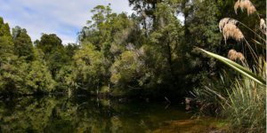
Time: 15 min one way
Distance: 650 m
Canoe cove is a small inlet at the head of Lake Kaniere. It is accessed via a track which begins at the carpark opposite the Hans Bay Road/ Milltown Road junction. This walk leads through dense stands of rimu and kahikatea forest to a sheltered sandy beach suitable for picnics and swimming.
Time: 1 hr loop walk
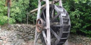
This walk is a great option for kids – with tunnels and other gold mining relics there is plenty to keep them interested. From the car park at the Ross Goldfields Information and Heritage Centre; the Water Race Walkway follows Mt Greenland Road for about 15 minutes before turning onto a sign posted forest track on the right side of the road.
The track climbs to an old water race and then follows this through regenerating native forest, passing numerous old gold workings including tunnels, several dam sites and a replica miner’s hut. After passing through the original Ross Cemetery, the walkway exits at the top of St James Street, with a short walk back to the car park. This is a walk that people of a medium to low level of fitness can enjoy.
Time: 20 minutes return.
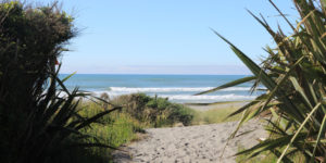
Intriguing walk through rare remnant of sand dune totara forest. Wonderful lonely driftwood-strewn beach.
Time: 5 min return
Distance: 50 m
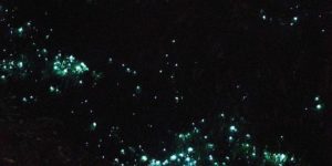
From State Highway 7 roadside at the northern town entrance. Parking available but can be walked to from town. 50 metre track leads to Glow-worm Dell. Free viewing of glow-worm colonies. Please note that Glow-worms can only be seen at night! Lovely fern grotto by day. Flashlight recommended.

Time: 2 hours one way.
Distance: 6 km
Follows old logging tramway route through a cross section of West Coast bush history. It crosses a diverse range of landscapes including boardwalked wetlands, natural terrace rimu forest and regenerating native forest & pine, eucalypt & monterey cypress plantings. Detour to lakeside Picnic Point along fine rimu-forest ridge worthwhile (40 minute return trip detour to Picnic Point). Open to mountain biking as well.

Time: 1 hour
Distance: 3.9 km return
The Douglas Walk takes you over glacial landforms formed between 1600 AD and 1750 AD by glacial advances and retreats. From the glacier road car park, the walk takes you through a succession of vegetation types, each representing a different stage of re-growth behind retreating ice and/or different soil types. Visit Peters Pool, a reflective kettle lake, and the historic Douglas Bridge.
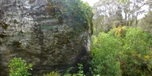
Time: 10 minutes
A short walking track passes through tailings and old goldworkings to view Londonderry Rock – a huge boulder too large for the miners to move or break.
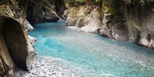
Time: 1 hour 20 minutes
Distance: 5.2 km
The Callery Gorge Walk begins approximately 5 minutes along the Tatare Tunnels Track with a short, gentle climb to a high terrace behind Franz Josef Waiau township, passing the town water supply pipes and tanks. The track narrows through the rainforest, and follows alongside an old gold mining water race. The water race and some rusty relics are among the last visual reminders of the gold mining era. The track then descends to the historic Callery Gorge bridge. From here there are views of the narrow Callery Gorge which has changed dramatically over the years due to gravel deposits filling in the gorge and raising the level of the riverbed.
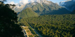
Time: 1 hour – 1 hour 40 minutes
Distance: 3.2 km – 6.3 km
The first 800 metres of track is along the river stop bank. A short, but steady climb then takes you through rainforest to the top of this granite outcrop, where you will get commanding views of the sea and lowlands to one side, and up the Waiho River to the glacier and Southern Alps Kā Tiritiri o te Moana from the other. The granite of Canavans Knob is much older than the schist rocks of the glacier valley across the Alpine Fault Line, and therefore it survived the scraping of glacier ice 9000 years ago.
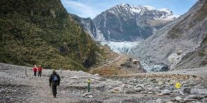
Time: 1 hour return
Distance: 2.6 km
After walking for a few minutes, the first view of the glacier will appear. Follow the track down past the landslip zone – do not stop in this area. The track continues towards the glacier and crosses several small creeks. The final section of track to the safety barriers includes a short climb up to the viewing area. The walk leads you to within about 500 m of the glacier terminal face.
Viewing the glaciers is an exciting experience, but it can also be dangerous. The glacier is constantly moving. Ice and rock fall from the terminal face without warning. Observe all signs and stay behind barriers to have a safe and enjoyable visit.
Time: 1 hour 30 minutes
Distance: 2.6 km loop
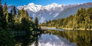
Lake Matheson is nestled in ancient forest and is famous for mirror views of Aoraki/Mount Cook and Mount Tasman. Its excellent reflecting properties are due to the dark brown colour of the water – the result of organic matter leached from the humus of the forest floor. Dawn and dusk are the best times to enjoy the reflections in the lake.
Time: 20 minutes
Distance: 900 m
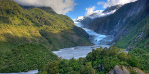
This short steady climb up a now bush-covered ice-scraped rock offers the most impressive views of the glacier and the Waiho River. Information panels at the viewpoint show dramatic photos of the glacial retreat, making it one of the best places to appreciate the power of the glacier.
Sentinel Rock emerged from beneath the glacier in 1865 and is an example of how the glacial ice ground the hard schist bedrock into a Roche moutonnee or ‘rock sheep’. Since 1909 the glacier has retreated over 3 km and plants have progressively colonised where a veneer of rubble has been dumped over bedrock in the valley.
Westland District Walks

West Coast Travel Centre
Mackay Street
PO Box 186
Greymouth
Phone: 03 768 7080
Fax: 03 768 7090
Email: info@westcoasttravel.co.nz


