Nature Wildlife
Scenic
Buller district walks to do while in the area. Enjoy short to long walks, bush or sea scenery.

Shorter option: Tauranga Bay carpark to seal colony viewpoint
Time: 15 min
Distance: 500 m
Cape Foulwind short walk takes you from Tauranga Bay along a rocky headland to a viewpoint overlooking a New Zealand fur seal breeding colony.
Panels along the track tell stories of Māori history, sea voyages and early explorers.
Longer option: Seal colony viewpoint to Cape Foulwind lighthouse
Time: 1 hr
Distance: 2.9 km
From the seal colony, a longer walking track leads to Cape Foulwind lighthouse.
Return the same way or arrange transport from Cape Foulwind car park.
Time: 3 hours one way
Distance: 6.8 km
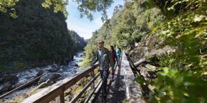
Accessible from Ngakawau or behind Seddonville, an old railway formation passes through an area packed with botanic and geological interest. Historic features include tunnels, sawmill and coal mine remains. A scenic highlight is a suspension bridge giving an unfolding view of the Mangatini Falls. There are shorter walking options from both ends.
Time: 45 minutes, one way
Distance: 2 km
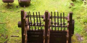
The walkway begins at the Lyell picnic and camping area, located 17 km from Inangahua Junction and 35 km from Murchison. A stamping battery which crushed gold-bearing quartz from the Croesus Mine is the main destination of the walkway. Other features along the way include a picturesque goldfield cemetery and interesting mounds of stones (tailings) left by alluvial miners after gold-bearing gravels had been sluiced away. Return the same way or via the historic ‘Old Dray Road’.

Time: 3 hours up, 2 hours 30 minutes down
Distance: 4.2 km
Signposted from Conns Creek Road behind Waimangaroa at the bottom end, and Denniston township at the top, a bridle track makes a pleasant if steep bush walk. A short branch track near the top leads to the incline that carried coal down (and occasional cool-nerved passengers up). A lower branch to the Waimangaroa-Denniston road offers a shorter walking option. Aside from the incline, which was used for transportation of coal, the bridle path, completed in 1884, was the only means of access to Denniston. Travel along this route was either by horse, or on foot.

Time: 25 min, one way
Distance: 1 km
From the first car park a well-formed track leads up the Oparara riverbank, through beech and podocarp forest and past limestone outcrops. The arch is 219 metres long with sides 79 metres apart and a roof 43 metres above the river that carved the impressive feature.

Time: 1 hr 30 min round trip
Distance: 4.1 km
This walk is a great option for children with a limestone arch, reflective tarn and interpretation panels to keep them interested.
From the main Oparara car park follow the track to the Moria Gate Arch. Smaller than the Oparara Arch, the Moria Gate Arch is very pretty and should not be missed. It is 19 metres high, 43 metres wide and fully deserving its ‘Lord of the Rings’ name. The track continues over the arch highlighted by the paving stones. After passing the turn off to the Oparara Valley Track Mirror Tarn emerges offering spectacular reflections of the surrounding rain forest. Continue on to the Mirror Tarn carpark where a short walk along the road takes you back to the Oparara car park.
Time: 4 – 6 Days
Distance: 78.4 kms
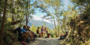
The Heaphy Track is well formed and well-marked. All major stream and river crossings are bridged. You can start the track either from Brown Hut in Golden Bay (156 km from Nelson) or from Kohaihai on the West Coast (110 km from Westport). It’s not a circuit track and is described here from Golden Bay to Kohaihai.
Popular walking options:
For a 4 day, 3 night trip, most walkers stay at Perry Saddle, James Mackay and Heaphy Huts.
For a 5 day, 4 night trip, most walkers stay at Perry Saddle, Saxon, James Mackay and Heaphy Huts.
A popular 2 day, 1 night trip on the western side is from Kohaihai to Heaphy Hut, returning to Kohaihai.
Time: 15 mins
Distance: 700 m, one way
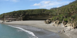
Truman Track is a walk through unspoiled sub-tropical forest where podocarp and rata trees tower above thickets of vines and nikau palms. The track emerges on a spectacular coastline with cliffs, caverns, a blowhole and a waterfall which plummets straight onto a rock-strewn beach. A stairway provides access to the beach, which may be safely explored when the tide is out.
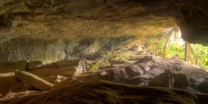
Time: Take as long as you like
Distance: 130 metres
A wooden stairway gives access to 130 meters of safe passages with a few stalactites and the odd glow worm. Plenty of fun for all ages, as long as a good torch (and preferably a spare) is carried.
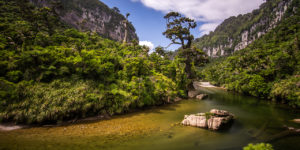
Time: 1 hr
Distance: 3.5 km, one way
This track follows a spectacular limestone gorge with two main features – a river with huge rocks in deep pools, and beautiful forest featuring subtle changes from sub-tropical to temperate.
A 15 minute gentle stroll from the car park brings you to a seat and a lookout, with spectacular views of the river gorge with its magnificent limestone cliffs. From this point on, the track narrows and the gradients become a little steeper as the track continues for another 2.5km until it meets the Inland Pack Track. Five minutes beyond this junction the track leads to the riverbed, an ideal place for a rest before retracing your steps back to the car park.
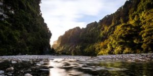
Time: 2 hr
Distance: 6 km, one way
Caution: Several river crossings – dangerous in flood.
Some of the park’s finest limestone features can be seen in this area. The track follows the Fox River and continues up the gorge to a point where the river branches. The large limestone overhang, known as the Ballroom Overhang is about half an hour up the left or main branch of the river.
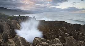
This is an all weather walk around the famous Pancake Rocks and Blowholes. Looking like giant pancakes the curious limestone formations are especially spectacular at high tide in a westerly sea.
With the exception of an optional short section with steps, the walk is suitable for wheelchairs (with assistance). As the rocks are both fragile and dangerous, it is important to stay on the path. The blowholes are at their best around high tide when there is a westerly swell.
Buller District Walks

West Coast Travel Centre
Mackay Street
PO Box 186
Greymouth
Phone: 03 768 7080
Fax: 03 768 7090
Email: info@westcoasttravel.co.nz


